XGRIDSDocs
  • 简体中文
  • English
  • 繁體中文
  • 日本語
  • Deutsch
  • Español
  • Italiano
  • Français
  • Русский
  • 简体中文
  • English
  • 繁體中文
  • 日本語
  • Deutsch
  • Español
  • Italiano
  • Français
  • Русский
  • PortalCam

    • Product Overview
    • Basic Operation
    • Using the LCC Scan App
    • Maintenance and Care
    • FAQ
  • Lixel K Series

    • Lixel K1

      • Product Overview
      • Basic Operation
      • Device Activation and Connection
      • Scanning Workflow
      • Acquire Point Cloud Data with Absolute Coordinate
      • Map Fusion
      • Route Planning Suggestions for Typical Scenes
      • Precautions
      • FAQ
    • Lixel K2

      • Product Overview
      • Basic Operation
      • Device Activation and Connection
      • Scanning Workflow
      • Acquire Point Cloud Data with Absolute Coordinate
      • Map Fusion
      • Route Planning Suggestions for Typical Scenes
      • Precautions
      • FAQ
  • Lixel L Series

    • Lixel L2 Pro

      • Product Overview
      • Basic Operation
      • Device Activation and Connection
      • Scanning Workflow
      • Acquire Point Cloud Data with Absolute Coordinate
      • Measure Point
      • Appendix
      • FAQ
  • Lixel Studio

    • Version and Copyright
    • Installation and Activation
    • Software Interface
    • File Operations
    • Project Processing
    • Tools
    • 2D Drawing
    • Applications
    • Settings
    • Device Connection
  • Lixel CyberColor

    • LCC Studio

      • Getting Started
      • Version and Updates
      • Download and Installation
      • Interface Overview and Navigation
      • Before Reconstruction
      • Model Reconstruction
      • Single Model Reconstruction
      • Map Fusion
      • Aerial-Ground Fusion
      • Aerial Reconstruction
      • My Models
      • Other Features
      • Settings and Account
      • Converter
      • Video Reconstruction
      • FAQ
    • LCC Scene Editor

      • Version & Updates
      • Account & Login
      • Product Overview & Home
      • Editor Interface
      • Scene Navigation Modes
      • File
      • Settings
      • Edit Operations
      • Window
      • Global Toolbar
      • Assets & Properties
      • Left Toolbar
      • Viewpoints
      • Portal
      • Skybox
      • Annotations
      • Measurement
      • Flythrough
      • Scene Report
      • 3D Layout
      • Mini-Map
      • Preview Mode (Viewer)
      • Help
      • FAQ
      • Spawn Point
    • LCC Model Editor

      • Version and Updates
      • User Guide
      • Overview and Interface
      • File Operations
      • Selectors
      • Editing Models
      • Measurement
      • Color Grading
      • Asset Management
      • Settings and Help
      • FAQ
    • Capture Guide

      • Overview
      • Capture Devices Overview
      • General Capture Principles
      • Indoor Scene Capture
      • Outdoor Scene Capture
      • Large-Scale Capture (Map Fusion)
      • Aerial-Ground Map Fusion Capture
      • Object Capture
      • People Capture
      • Video Reconstruction Capture
      • HD Enhancement
      • Control Points (Lixel P1)
      • FAQ and Troubleshooting
    • Version History
  • Plugin & SDK

    • Unreal

      • Introduction
      • Quick Start - Windows
      • Quick Start - Linux
      • Quick Start - Quest3
      • Editions and Licensing
      • Rendering
      • Visual Settings
      • Normals and Lighting
      • Scene Editing
      • Performance Parameters
      • Performance Guide
      • Third-party and Engine Plugin Integration
      • Proxy Mesh
      • Loading Animation
      • Collision
      • Navigation System Support
      • Single Layer Water Support
      • Localization
      • FAQ
      • Troubleshooting
      • Logging and Diagnostics
      • Contact Us
      • API Reference

        • ALCCActorBase
        • ULCCComponentBase
        • ULCCComponent
        • ULCC2Component
        • SOG / SPZ / PLY Actors
        • ALCC2ProxyMesh
        • ALCCClippingVolume
        • ALCCSectionPlane
        • ULCCUtilLibrary
        • Enums
        • Structs
      • Changelog

        • v3.3.1
        • v3.0.0
        • v2.2.1
        • v1.0.0
        • v0.9.0
        • v0.8.0
        • v0.7.1
        • v0.6.1
        • v0.5.2
        • v0.4.1
        • v0.4.0
        • v0.3.0
        • v0.0.5
        • v0.0.4
        • v0.0.3
        • v0.0.2
        • v0.0.1

File Operations

This chapter covers importing and exporting data, and opening, saving, and deleting projects.

Import Data

Import data from a file into the current window. Supported formats:

  • Point clouds: .las (1.1–1.4), .laz, .ply, .e57
  • Control points / trajectory: .csv, .txt
  • Mesh models: .ply, .obj, .osgb
  • Other: .lcc, .dxf (CAD)

Import LAS Data

After selecting a .las file, you can set a render offset. This offset is used only to optimize point cloud rendering in the viewport and resolve render jitter under large coordinates — it does not modify the original coordinate data in the point cloud file.
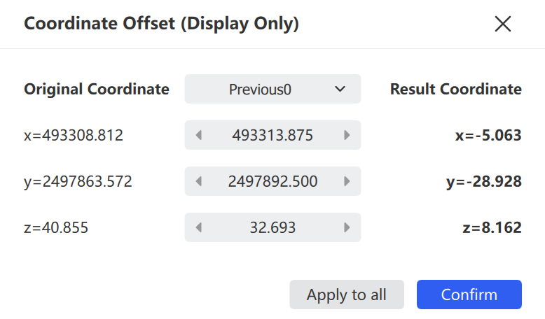
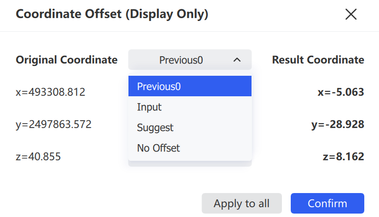
Import LAS
Import LAS
Imported point cloud data

Imported point cloud data in the display window

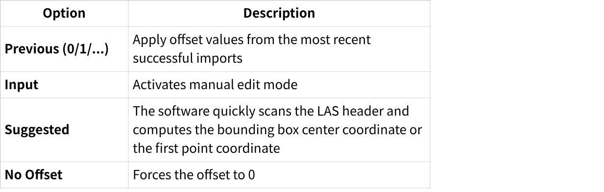
OptionDescription
Previous (0/1/2)Automatically remembers the offset values used in the most recent imports
InputActivates manual edit mode
SuggestedScans the LAS header to calculate the bounding box center or the first point's coordinates
No OffsetForces the offset to 0

Note: If the imported point cloud renders with a striped pattern, it is usually caused by an unsuitable offset value. Delete the *_potree folder with the same name as the point cloud in the same directory, then re-import.

Import Control Points and Trajectory TXT/CSV Data

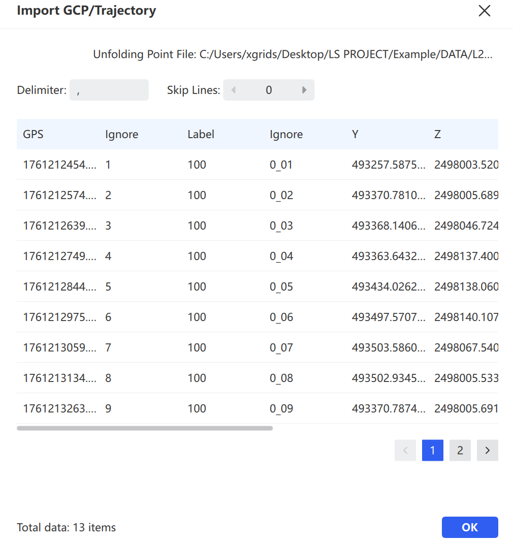
  1. After selecting a .txt or .csv file, choose the delimiter and whether to skip header rows in the dialog.
  2. Click Confirm to import.
Import settings

Import parameter settings

If the imported control points include label information, they are displayed with a special marker.
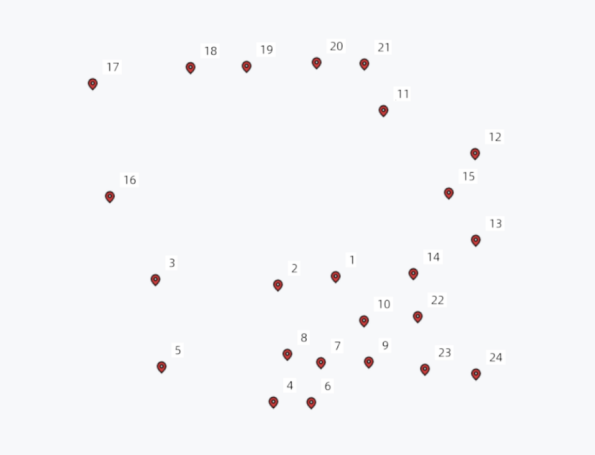
Control point display

Control point display

Standard trajectory data is rendered in a point cloud–like style.
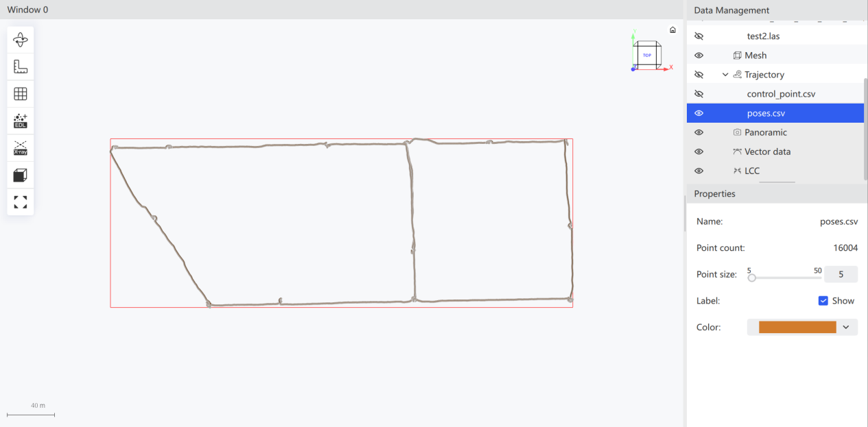
Trajectory data

Trajectory data display

Import Mesh Model

Select a .ply, .obj, or .osgb file.
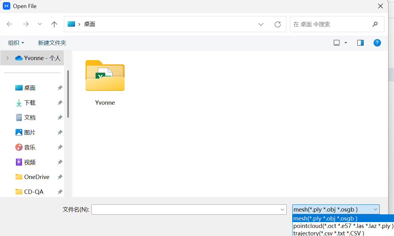
Import mesh

Open Project

Same functionality as in the home page. See Software Interface for details.

Export Data

Export the selected point cloud data. Supported formats: las, laz, ply, and unstructured e57.

  1. Select the point cloud data to export.
  2. Choose the export directory and filename.
  3. Select the export format.
  4. Click Export.
Export data

Save Project

Click Save to save the files within the project.

Delete Data

  1. Select one or more data files in the data list.
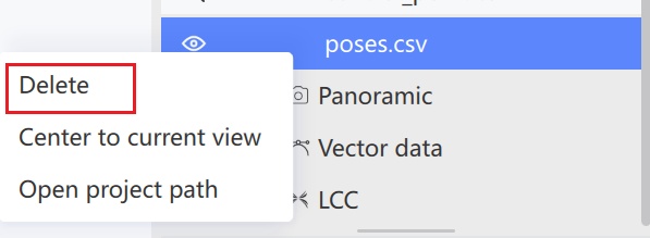
  2. Click Delete, or right-click and select Delete.
  3. Confirm the deletion.
Delete data
Delete data

Note: This action deletes data files within the project. Confirm before proceeding.

Prev
Software Interface
Next
Project Processing